
Point One Navigation · Nationwide RTK

Nationwide 1–2 cm RTK, on one login.

Point One runs thousands of professionally managed base stations across the country. Put the login in your Emlid, your DJI RTK drone or your LiGrip and get a fixed solution without setting up a base. Corrections come over a data SIM or your phone's connection.

  • Single Baseline RTK and Network RTK: 1–2 cm
  • Virtual RTK (VRS) in every corner of the lower 48: 3–7 cm
  • NAD83(2011) straight out of the box
  • Works with any dual- or tri-band receiver that takes NTRIP
True RTK · 1 year
$750 1–2 cm. Opens all three services.
Virtual RTK (VRS) · 1 year
$350 / year 3–7 cm. GIS and mapping.
With any GNSS receiver from us
$500
True RTK, first year, bought with the receiver
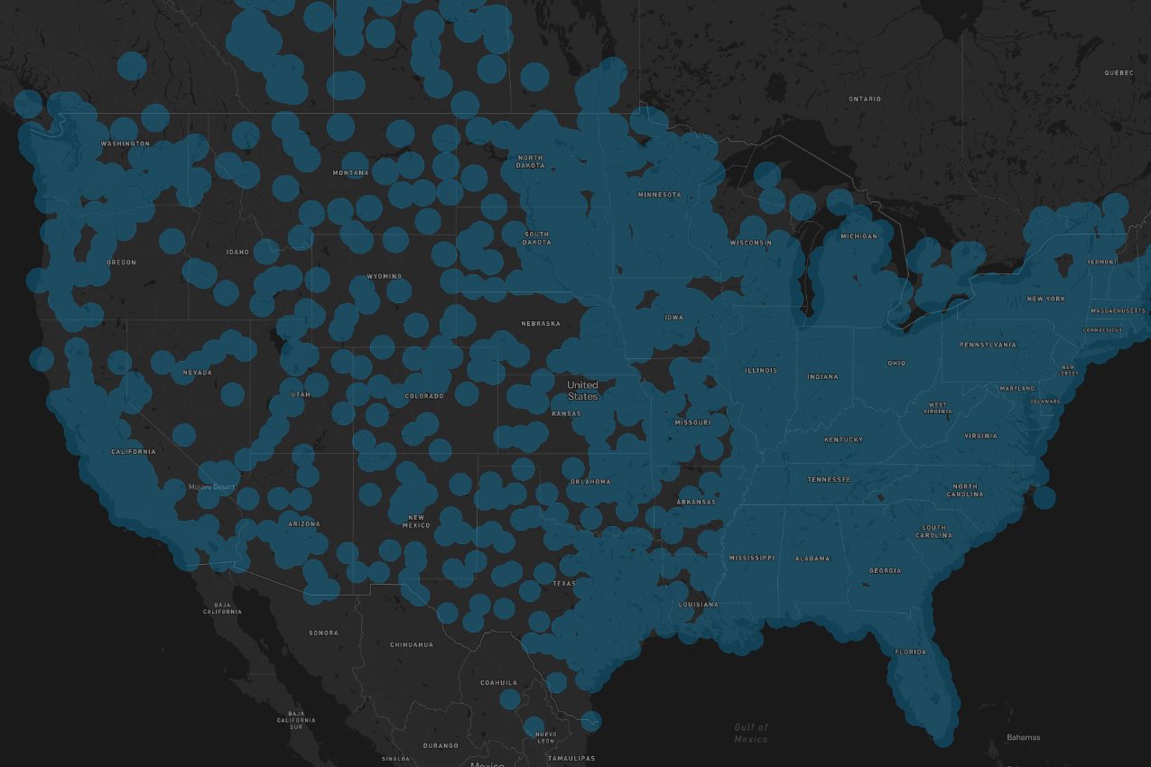
Map of Point One True RTK base station coverage across the United States
Know which service you are on

1–2 cm or 3–7 cm: not all RTK is the same.

A True RTK subscription opens all three Point One services, so you pick the one the job needs. A Virtual RTK subscription opens Virtual RTK only.

True RTKSurvey-grade

Single Baseline RTK

1–2 cmhorizontal and vertical

Corrections straight from the nearest physical base station. The fix comes almost at once and the result is what a surveyor expects from RTK.

Use it for Boundary and topo, control, construction stakeout, drone GCPs and checkpoints

truertk.pointonenav.com · port 2101 (2102 TLS)

True RTKSurvey-grade

Network RTK

1–2 cmhorizontal and vertical

A solution built from several base stations around you, so it holds up when you work between stations.

Use it for The same survey work across a larger site

networkrtk.pointonenav.com · port 2101 (2102 TLS)

Virtual RTK (VRS)Good, not survey-grade

Virtual RTK

3–7 cmhorizontal and vertical

Modeled corrections that reach everywhere in the lower 48, even far from a base station. Good, dependable service, but it is a few centimeters, not one or two.

Use it for GIS and asset mapping, utility locates, ag and machine guidance

virtualrtk.pointonenav.com · port 2101 (2102 TLS)

VRS is good service, but it is 3–7 cm, not 1–2. Many correction plans are virtual (VRS), including most of the free ones that come with a new receiver. That is fine for GIS and mapping. For boundary, control, stakeout and drone ground control, connect to Single Baseline or Network RTK and work at 1–2 cm.

Accuracy figures are Point One Navigation's, from its connection guide. As with any RTK, check a known point before you start work.

Coverage

Check your job site.

Switch between Virtual RTK and True RTK at the top of the map, then search an address, city or ZIP. Point One adds base stations every week.

Open the map full screen →
Getting connected

Three steps from order to FIX.

Any NTRIP client works: Emlid Flow, FieldGenius, DJI Pilot 2, SurvPC and most data collectors.

1

Pick your plan

True RTK is $750 a year, or $500 for the first year when you buy it with any GNSS receiver from us. Virtual RTK is $350 a year. Each plan is one login for one device.

2

We send your login

After your order, we email your username, password and mount point, with these settings.

3

Enter it as an NTRIP connection

In Emlid Flow, open your receiver's correction input and choose NTRIP. On a DJI controller, choose Custom Network RTK. Enter:

  • Address: truertk.pointonenav.com (or networkrtk / virtualrtk)
  • Port: 2101
  • Mount point: LOCAL for NAD83(2011) in the US
  • Your username and password

Check: Wait for FIX, then shoot a known point before you start work.

Questions we get about RTK service

What is the difference between True RTK, Network RTK and Virtual RTK?

Single Baseline (True) RTK uses the nearest physical base station. Network RTK combines several stations around you. Both are 1–2 cm. Virtual RTK (VRS) models corrections so it reaches everywhere in the lower 48, at 3–7 cm. A True RTK subscription opens all three. A Virtual RTK subscription opens Virtual RTK only.

Which datum do the corrections give me?

On the LOCAL mount point you get NAD83(2011), epoch 2010.0, in the US (NAD83 PA11 in Hawaii). The AUTO mount point gives ITRF2014 at the current epoch. Most survey and drone work in the US wants LOCAL.

Will it work with my receiver or drone?

It works with any dual-band or tri-band RTK receiver that takes NTRIP corrections: Emlid Reach RS4, RS4 Pro, RX2 and RS3, DJI RTK aircraft with custom network RTK, GreenValley LiGrip with its GNSS module, and most survey receivers. Single-band receivers are not supported.

Do I need internet in the field?

Yes. Corrections come over the internet, from a data SIM in the receiver or your phone's connection. Where there is no cell signal, a base and rover over LoRa radio is the answer, and we sell those too.

How many devices does one subscription cover?

One. Every device gets its own username and password, so a crew running two rovers and a drone needs three logins.

How do I get True RTK for $500?

Buy it with any GNSS receiver from us. Tick the RTK box on the receiver's page, or add both to your cart, and the $500 price comes off at checkout. Bought on its own, True RTK is $750 a year, the same as Point One's own price.

Not sure which plan fits your work?

Tell us your receiver and the job. We will tell you straight whether VRS is enough or you need True RTK.