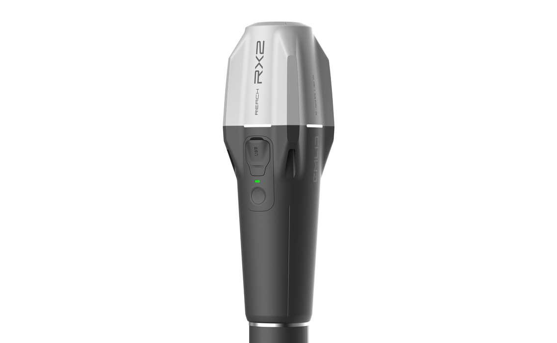


Emlid Reach RX2
INSTOCK AND READY TO SHIP
Lightweight, all-band RTK GNSS receiver with tilt compensation
Designed specifically for use with NTRIP corrections.
Comes with a mobile app.
Precision
RTK: 7 mm + 1 ppm
Tilt compensation: RTK: 2 mm + 0.3 mm/°
GNSS
GPS: L1C/A, L2C, L5
GLONASS: L1OF, L2OF
Galileo: E1-B/C, E5a and E6
BeiDou: B1I, B1C, B2a and B3I
QZSS: L1C/A, L1C/B11, L2C and L5
NavIC: L1-SPS data and L5-SPS
280 g
Compact and lightweight
16 hours on one charge
Li-ion battery with USB Type-C charging
MFi-certified
Seamlessly integrates with popular iOS and Android apps such as ArcGIS Field Maps, Survey123 and QField
Package includes
– Reach RX2
– USB Type-C cable
Network RTK rover with centimeter accuracy
Pocket-sized and lightweight receiver.
Works with NTRIP corrections.
Easy to set up: just add NTRIP
Reach RX uses Bluetooth allowing you to connect and start surveying in a few seconds. No settings to get wrong.
Pocket-sized and lightweight
The weight of Reach RX is just 250 grams.
Take it anywhere—it weighs less than a
can of soda and fits in any glove
compartment or a backpack pocket.
Centimeter accurate data
Reach RX tracks GPS/QZSS, Galileo,
GLONASS, and BeiDou and gets a fix in
under 5 seconds even in challenging
conditions.
Anyone on the team can use RTK
Reach RX is designed to meet the expectations of both experienced professionals and non-surveyors who need to get highly-accurate results. No training is required.
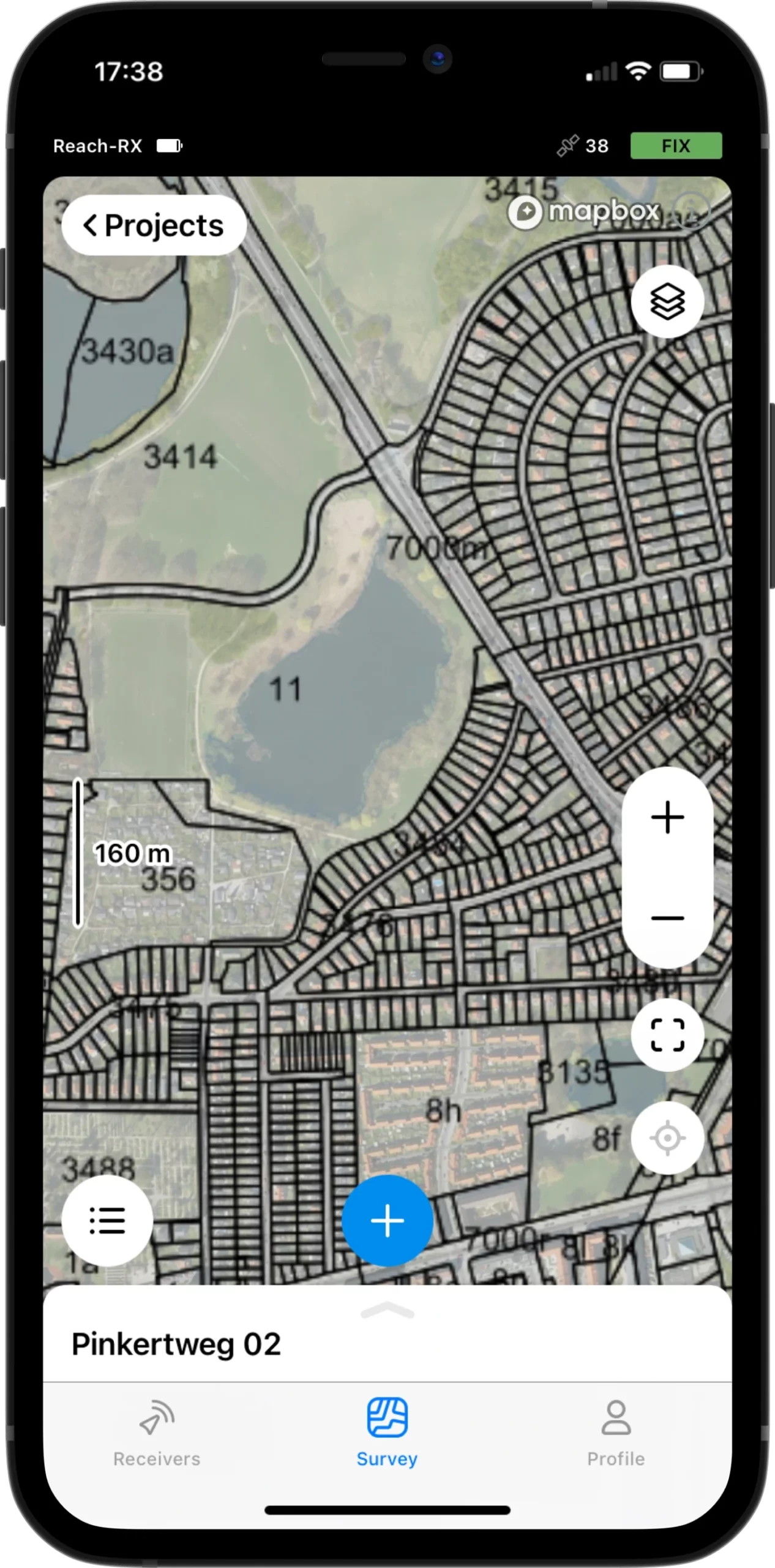
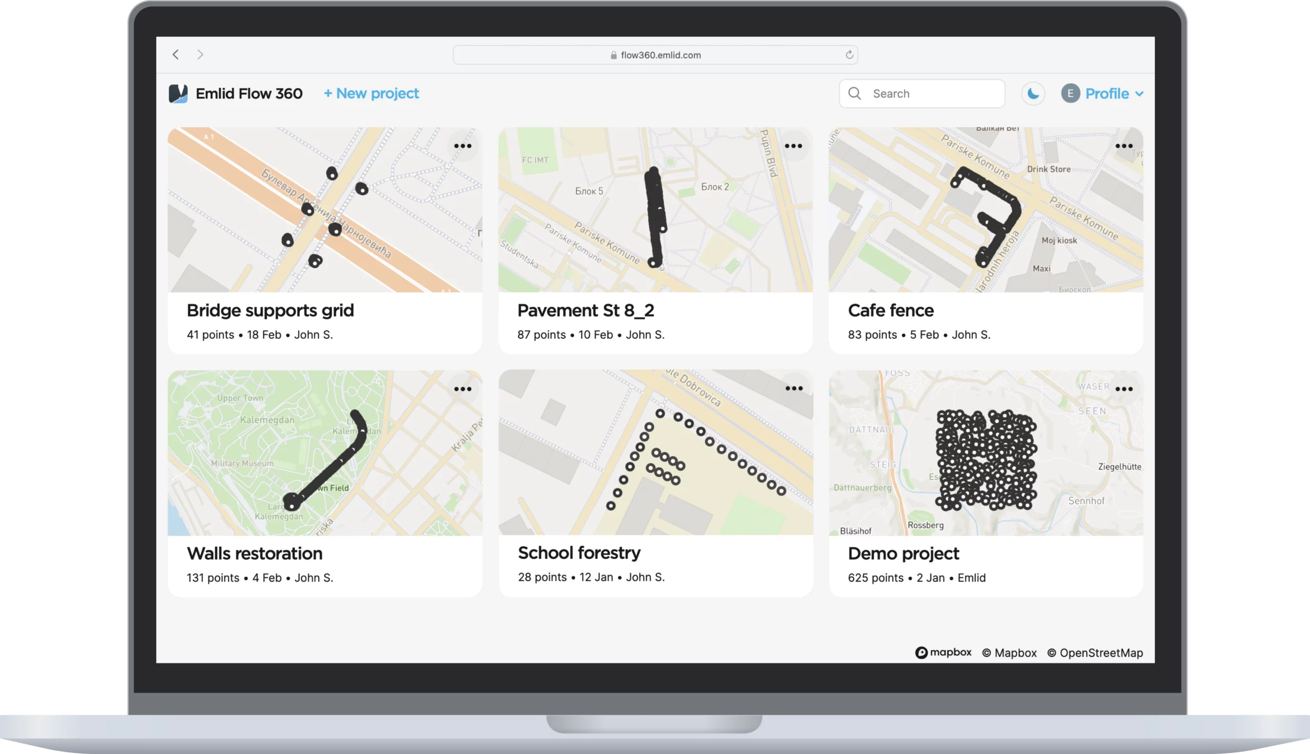
Survey with Emlid Flow and manage data with Emlid Flow 360
Emlid Flow is a mobile app for iOS and Android. It handles all the fieldwork— receiver settings, data collection, coding, linework, and stakeout. All survey data is in sync with the cloud-based service Emlid Flow 360, which allows you to access your projects from your browser and manage survey data and code lists.
Collect and stake out points
Use any coordinate system you need
To create a project for data collection, choose your coordinate system from the library or enter its parameters manually. The app supports thousands of coordinate systems, projections, grids, and geoids.
In the stakeout mode, the app displays East-North and straight-to-line distances and supports cut and fill indications. A close-up alignment mode helps you to center precisely above the point.
WGS84, NAD83(2011),
GDA2020, and others

Collect and stake out lines
Create linework on the go, start new lines, and continue collecting existing ones
You can either use predefined geometry types or a full-blown code library. The linework is displayed right away, so you can always see how your project is progressing.
During the stakeout, you can easily navigate to a line, and stake it out with an offset and with a chainage.
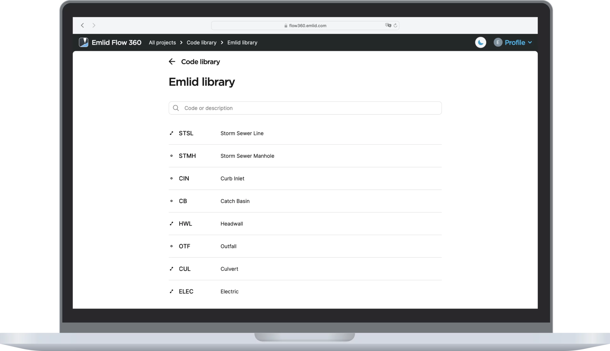
Coding
Quickly switch between different object codes as the whole library is at your fingertips at all times
To measure and describe objects, upload your custom code library or use a built-in one with more than a hundred codes. Easily create new codes on the fly right in your survey project.
Work with different
background maps
Upload topographic maps, cadastral plans, and aerial imagery from WMS and WMTS sources or work with a built-in satellite map.
Manage your projects in the cloud
The Emlid Flow app is synchronized with the Emlid Flow 360 service. This allows you to create and access survey projects, manage coordinate systems, and export and import data using both the mobile app and the cloud service at flow360.emlid.com.
CSV, DXF, and Shapefile
Manage your code libraries
Import your code library to Emlid Flow 360, and it is immediately available for your projects inside the Emlid Flow mobile app. No need to check if the latest version is on the collector, as it all syncs automatically.